
What GeoAI does
GeoAI is the intelligent platform that revolutionizes the way you analyze and manage territory. Thanks to the integration between GIS (Geographic Information System) and advanced artificial intelligence technologies, GeoAI allows you to detect, classify, and geolocate objects and infrastructure automatically, precisely, and scalably.
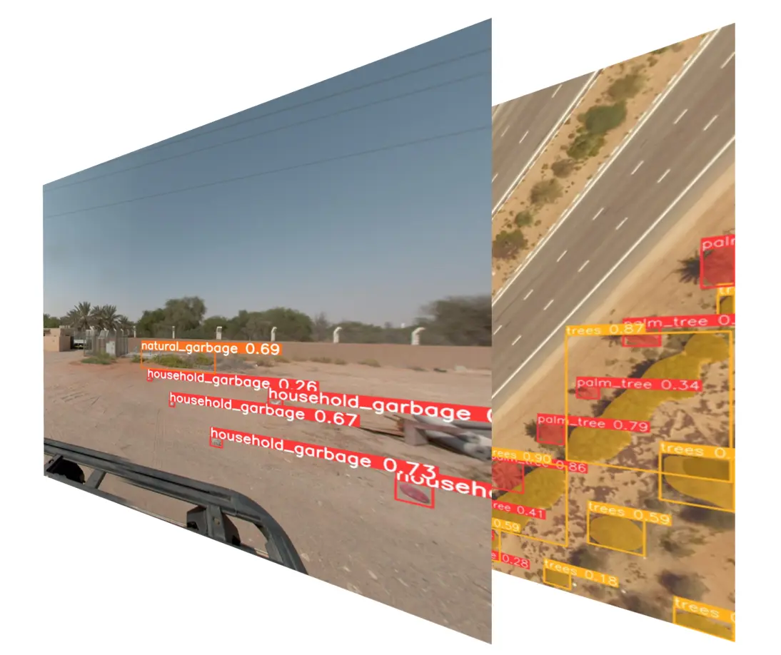
GeoAI leverages deep learning algorithms and convolutional neural networks (CNN) to analyze georeferenced imagery — such as 360° photos, aerial, or satellite images — and identify objects of interest within a specific area.
Whether it’s streetlights, road signs, trees, buildings, or waste, the system can recognize and catalog every element with precision, delivering results ready to be integrated into your GIS systems.
How it works
- Define the area of interest: Select the zone you want to analyze on the map.
- Upload or request images: You can provide existing imagery or request an acquisition service.
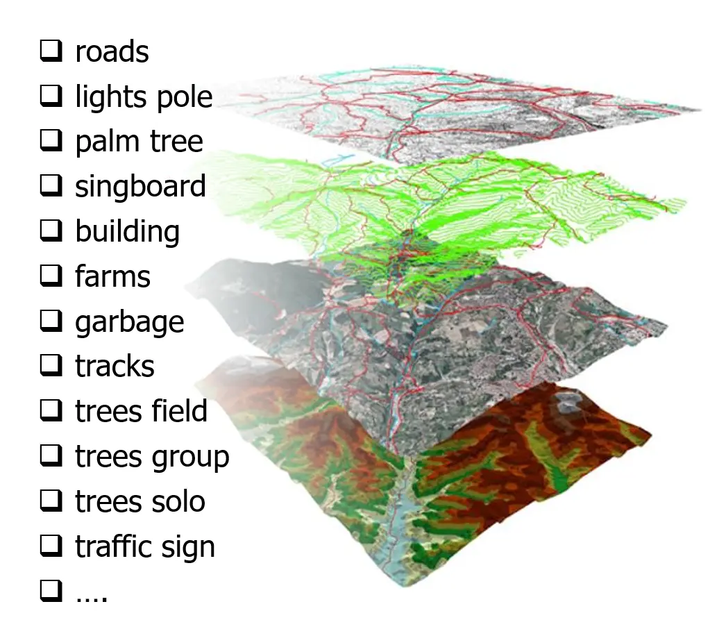
- Choose categories to detect: Select the objects you wish to identify (e.g., trees, signs, buildings, etc.).
- Receive an immediate quote: The system automatically calculates costs, timing, and activation methods.
- Get the results: You will receive images annotated with labels and a complete list of detected objects, including geographic coordinates and exportable metadata.
Benefits
- Automation: Reduce time and costs thanks to automatic object recognition.
- Precision: Advanced algorithms guarantee high accuracy in identification.
- Customization: You choose which categories of objects to detect.
- Integration: Data is compatible with any GIS platform or database.
GeoAI is the ideal solution for public entities, utility companies, urban planners, and anyone needing a detailed and up-to-date view of the territory.

